Carter Road Trails
Experience Florida's natural beauty through scenic wetlands and pine forests
About Carter Road
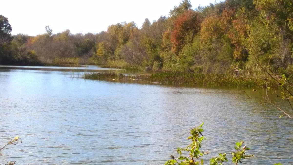
Carter Road (Loyce E. Harpe Park) is located in the Citrus Wildlife Management Area, offering a unique riding experience through the beautiful Florida swamplands. The trail provides a distinctive blend of scenic wetlands, pine forests, and occasional technical sections.
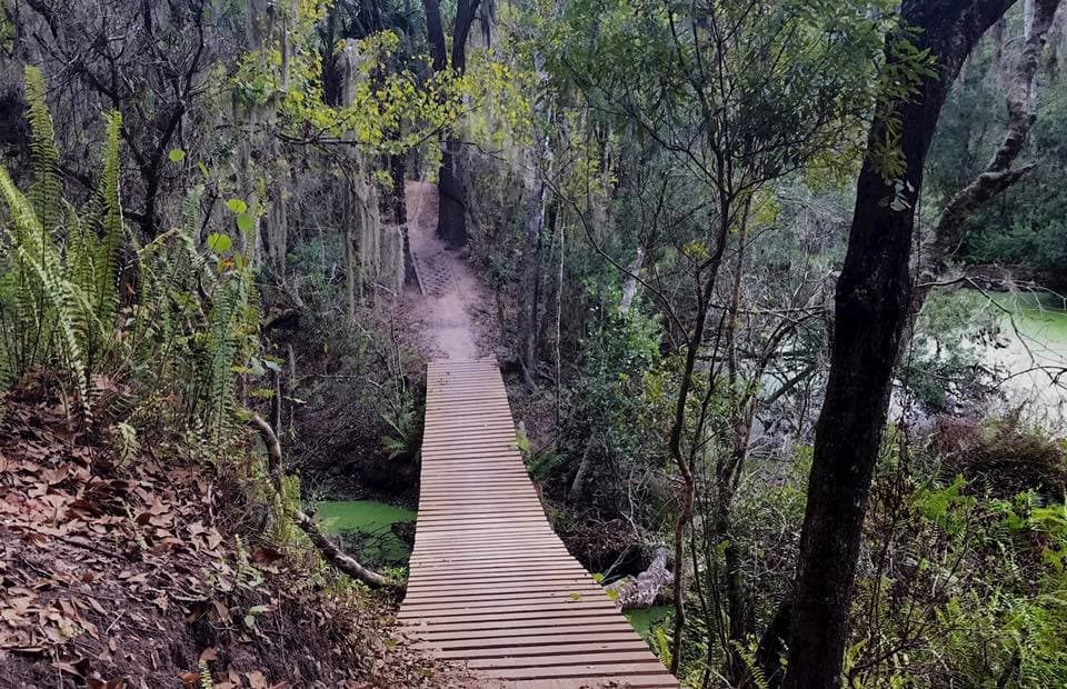
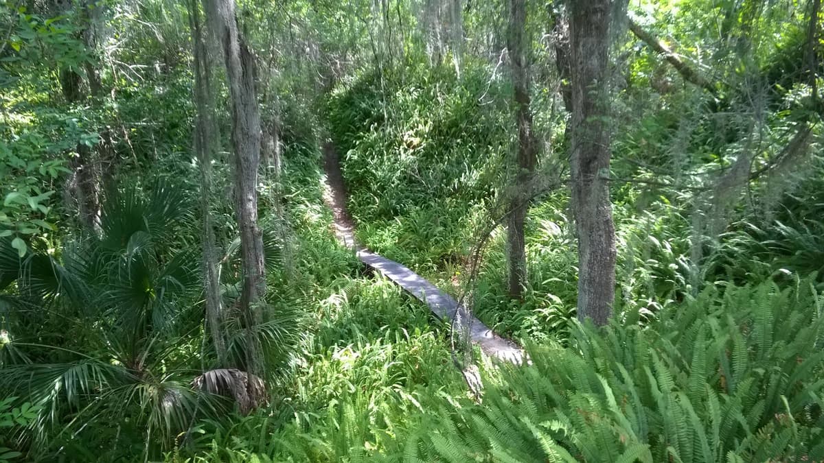
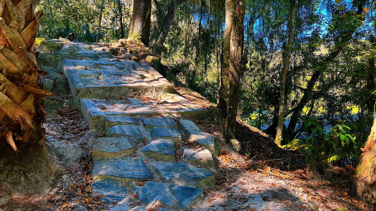
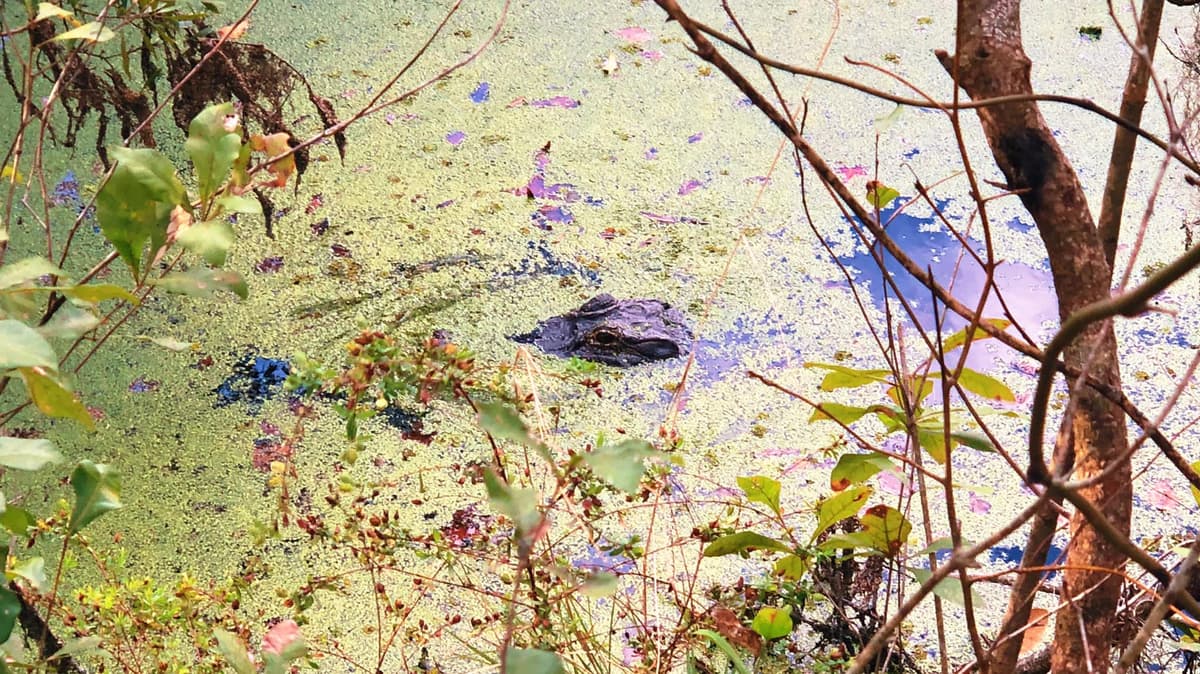
Known for its natural beauty, this singletrack trail winds through diverse ecosystems with wooden boardwalks crossing over wetland areas. Riders can expect to see abundant wildlife including birds, turtles, and occasionally alligators from a safe distance.
The trail system ranges from easy to intermediate difficulty, making it accessible to a wide range of riders. Some sections can become challenging after heavy rainfall, so checking trail conditions before visiting is recommended.
Trail Features

Pine Forest Singletrack
Flowing trails through tall pine forests, offering fast and scenic riding with a classic Florida feel.

Rock Gardens
Technical rock garden sections that challenge bike handling skills and provide a taste of rugged terrain.

Steep Climbs
Surprisingly steep climbs and punchy ascents, rare for Florida, that test endurance and power.

River Crossings
Scenic crossings and views along the Withlacoochee River, adding variety and beauty to the ride.

Quarry Sections
Trails wind through abandoned phosphate quarries, creating a natural playground of drops and features.

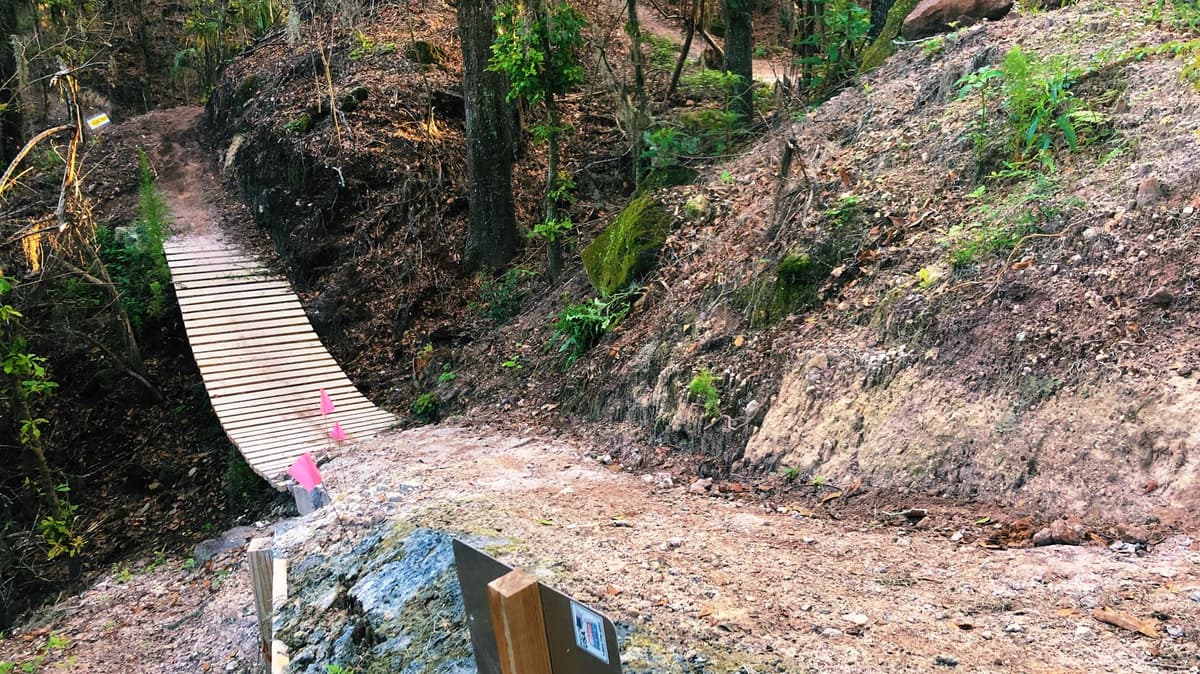
Long Wooden Bridges
Bridges and boardwalks over low-lying areas, providing both technical interest and access.
Maps & Directions
Driving Directions
From Tampa:
Take I-75 North to exit 301 (SR-50). Head east on SR-50 for approximately 12 miles. Turn north onto Carter Road. The main trailhead is Loyce E. Harpe Park.
From Orlando:
Take I-4 West to exit 58 (CR-54/Polk City). Continue west to US-98, then head north to SR-50. Turn left (west) on SR-50, then north on Carter Road.
Photo Gallery
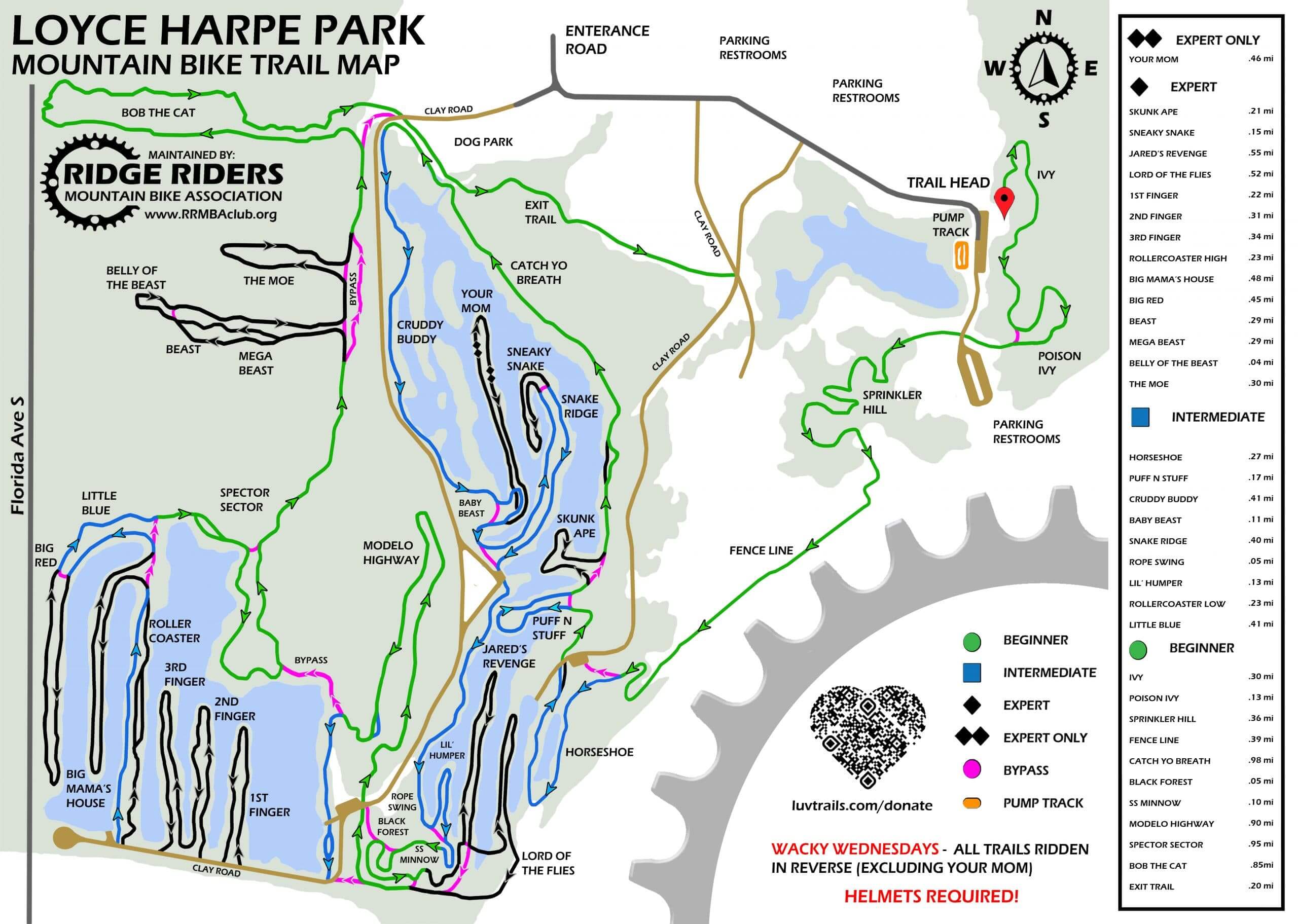
Trail Map
Ready to Ride Carter Road?
Grab your bike and helmet and experience some of Florida's best trails.